 |
| Barrier Lake |
Recently I had the overwhelming return of a childhood fear which I thought had been overcome in the last twenty years. Not so! It happened while in the mountains last Tuesday, when my husband and I were on a hike to Barrier Lake Lookout.
We got a late start, which was rather unfortunate as the hike was to take between 6 and 7 hours. The starting point was Barrier Lake in Kananasksis Country - a beautiful mountain lake created by a dam called Barrier Dam. The day was really hazy, and the smell of smoke was pretty strong in the air. Listening to CBC Radio as we drove toward the mountains, we learned that a large restaurant beside the highway had burned down overnight, (Chief Chiniki Restaurant) and when we passed it, the smoke was still rising as firemen were keeping an eye on the hot spots. I am not sure if the smoke in the air throughout the day was solely from that fire, but the day was quite hazy.
 |
| Jewel Bay |
We had decided to hike the trail in the opposite direction from what the guide book gave directions for, which meant walking along beside Barrier Lake for a stretch, until we reached this beautiful little bay called Jewell Bay. Just as I was taking this photo, two people entered the water on their stand up paddleboards - what a beautiful picture! We ate our lunch overlooking this bay before we began the climb up Jewell Pass Trail, which runs beside Jewell Creek.
The "up part" began right away. It was steady, one step after another of uphill while lifting our feet over tree roots the entire time. The trail is right on the edge of the creek bed, which sometimes was many, many feet downward on our left. The creek bed was dry, which we felt was unusual. In spite of no water running beside us, it was so humid in the forest that I was literally pouring sweat. Suffice it to say, I wished I had thought to bring a complete change of clothing for later. On this stretch of the trail, we passed by Jewell Falls, which had water flowing, but not in amounts that made the falls anything noteworthy. All the water did was add to the humidity. Perhaps it was the moisture in the air that make a perfect environment for all the butterflies that accompanied us most of the way up the mountain. There were probably 20 different types!
 |
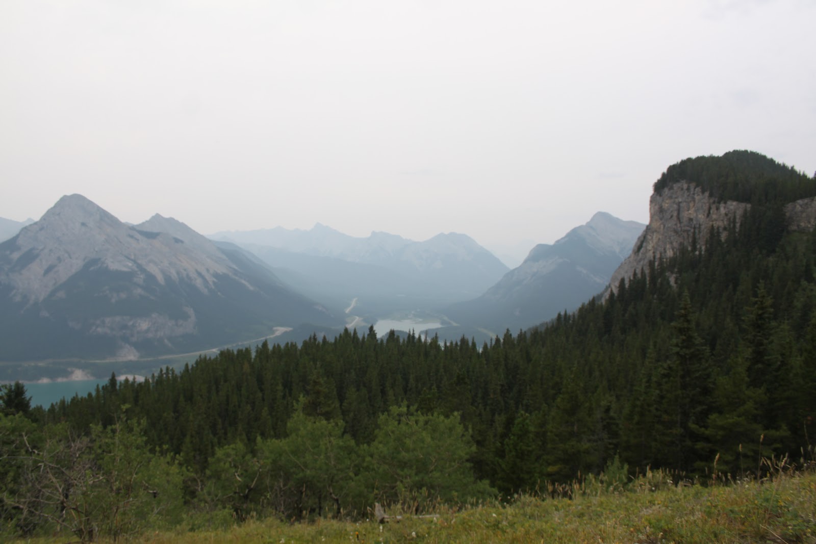
| Barrier Lake from the end of Prairie View Trail |
And the view was very, very HIGH.
 |
| Barrier Lake - slightly different view |
 |
| the #1 highway and prairies from near the top of Yates Mtn. |
But wait! There was more! That's right - we were not at the end of our "up". Where this trail took us, unless we wanted to return the 5 kms. we had just gained was up a scree slope that was like a rocky mountain goat trail cut into the side of a cliff. Seriously frightening. Seriously a moment to contemplate if all my affairs were in order, and whether my body would be found before winter sets in. There were parts of the goat trail that I am not ashamed to tell you I did in a crawling position. And when we conquered this part of the trail, I thought we were done. But wait! There is more!!! It was not enough to be at the "lookout site" as the guide book called it...Syd wanted to go to the top of Yates Mountain to see the prairie view and see the Ranger Station. There didn't seem to be any trail - just a bit of a path that might have looked like it was more traveled than everything around it. So that's where we went. But this time, I really could not even stand up. It was treacherous and difficult, and ever higher. We weren't even sure if we were going in the right direction. So Syd gave in to my desperate whimpering, and said we could turn around and go down. I managed to take a picture, and there was the prairie view at last...and the #1 highway. It was a truly spectacular view, breath-taking! Turning from taking the picture was like a slooooowwww motion time frame. It was so steep that I could not face it without feeling ill. Syd went first so that I could fall on top of him and take us both over the edge into oblivion should I trip. Angels must have helped me down that portion of the mountain, but I had no idea of what was waiting...there was now a new choice to be made.
Upon returning to the lookout site, we saw a sign that showed a hiker and an arrow. At last! A sign that showed the trail and where we were supposed to go! We found the trail and in a couple of minutes we were in a situation where I told Syd that I just couldn't do it. The path disappeared over the edge of the outcrop and you had to hang onto rocks like a rock climber in order to go down - backwards. There was a very teensy weensy shelf between those rocks and the actual edge of the mountain. It was horrifying. But my choice was to go this way, or become a mountain goat to scramble down the scree, and then step down over tree roots for 5 kms, then back 4 kms. to the dam. You know what I chose, right? I faced my fears, and thanked God for the years I have lived, and down I went, right after Syd. He was so supportive...that's just one of the reasons I love him!!!
 |
| the non-steep part of the path down |
 |
| Lac des Arc could be seen from here! |
 |
| so many butterflies!!! |
And as we got further down the mountain, I noticed a tree with several beautiful butterflies resting on it. Just fabulous!
We plan to go on another hike this week. I have requested one which does not test my fear of heights again so soon, so it is to be a very long hike (almost 20 kms.), but only "moderately strenuous". We shall see!
Barrier Lake Lookout Hike:
Height gain 616 m
High point 1996 m
distance of hike approximately 13 km
2 comments:
Hi Joanne:) I have laughed about your message but on the other hand I was sorry for you. What you'll have had a fear. As a result, you miss than many beautiful things. I know what it is to have fear of heights. I am completely paralyzed and cannot do a step more or I get seriously tend to jump down!
The photos are superb. What a beautiful environment for walking. I'm glad you're back unscathed again:)
So glad that you can relate to my fear of heights, Renate! There have been times in the past where I have missed seeing things which would have been wonderful, but I just couldn't do the height-thing. There is an actual reason for my fear, which I may reveal on my blog at some point in the future. For now, I am happy that I overcame this time, and managed to get off the mountain! Have a good weekend!
Post a Comment